Note: Users will need the "Create New Solar Reports" and "Upload Files" permissions enabled to access the orders page to View and Submit orders with site documentation. Org Admins can manage permissions following this guide.
Jump to:
Submitting Site Digitization Orders
Viewing Orders
Raptor Maps uses an orders system to process data and provide users with deliverables. Please note: all deliverables require a user to submit an order from their Raptor Maps account.
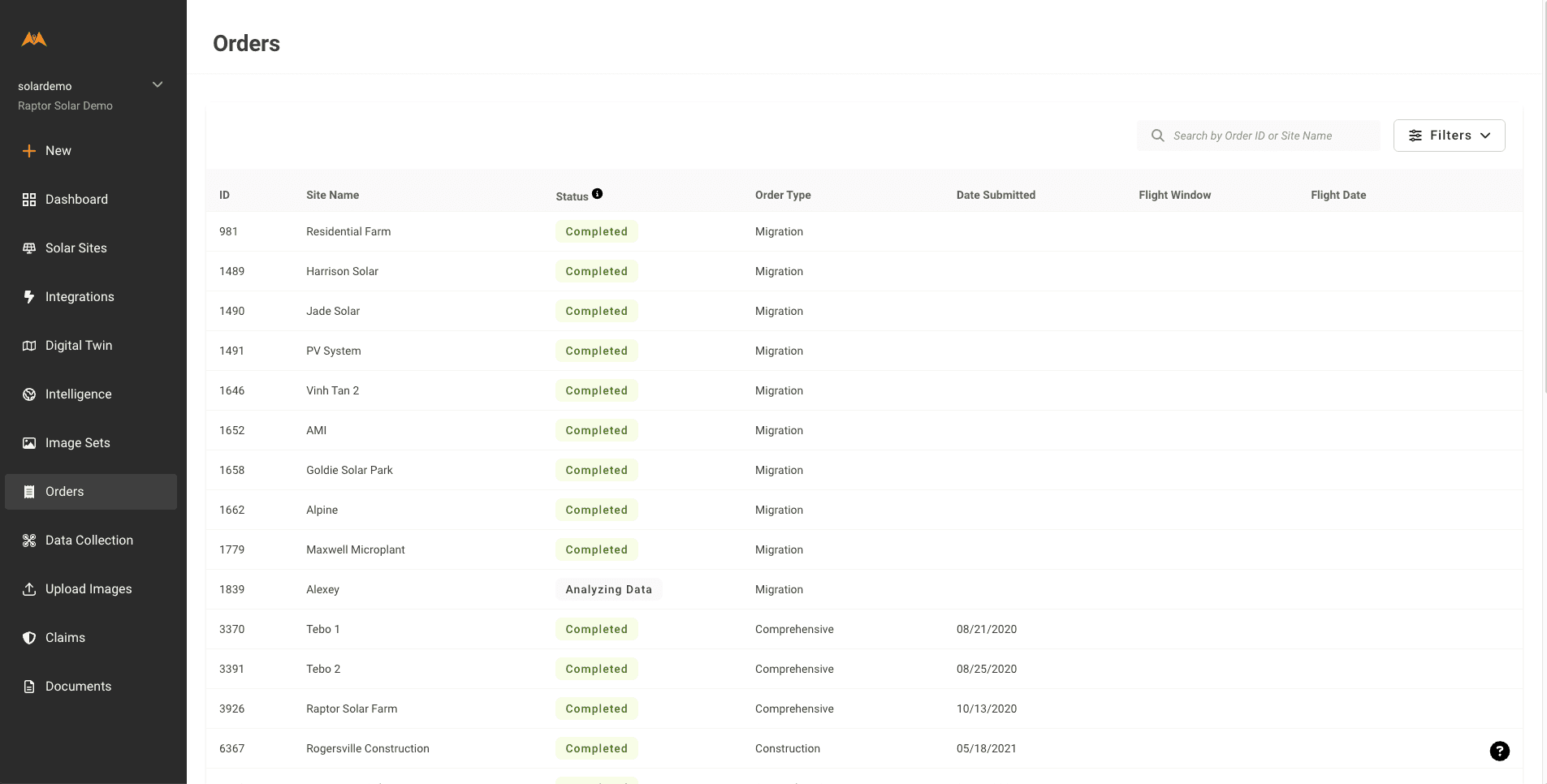
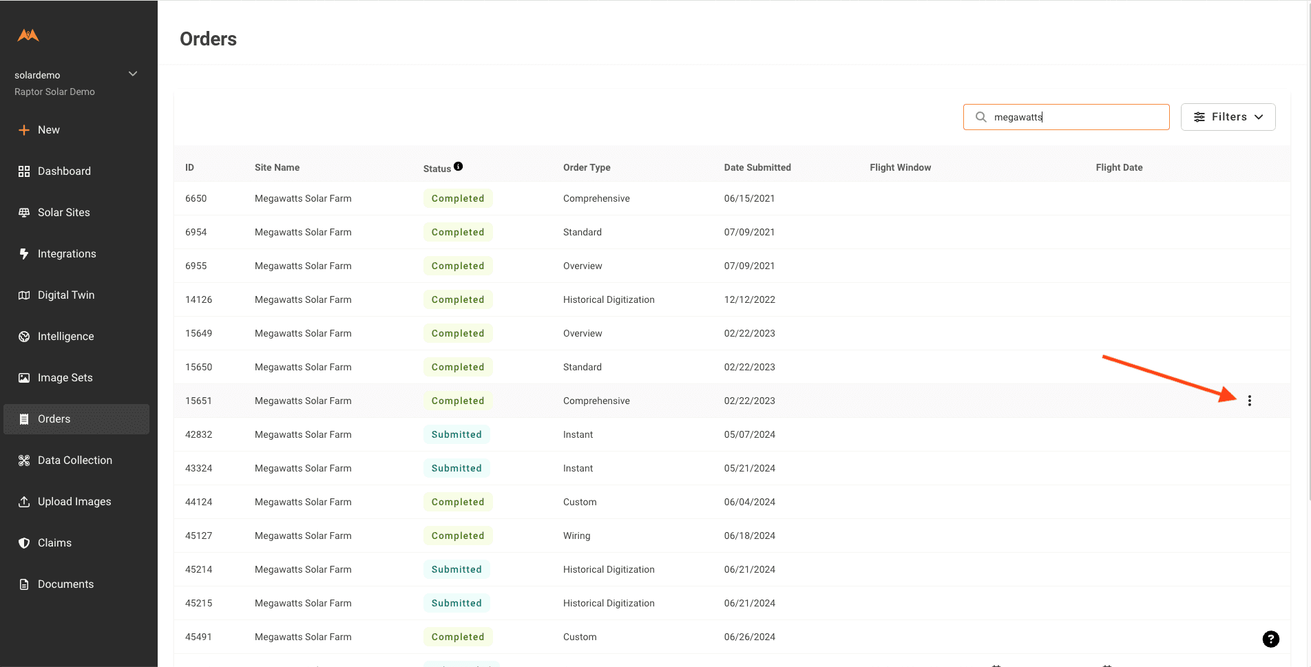
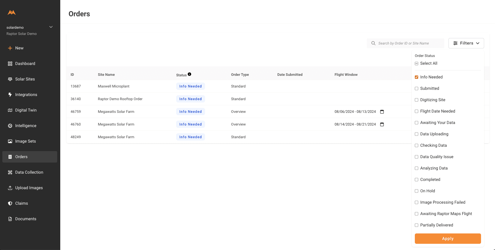
The Orders page allows users to view, search, and filter ongoing and delivered orders in list form. Use the left control panel to navigate to the Orders page.
Use the left control panel to navigate to Orders
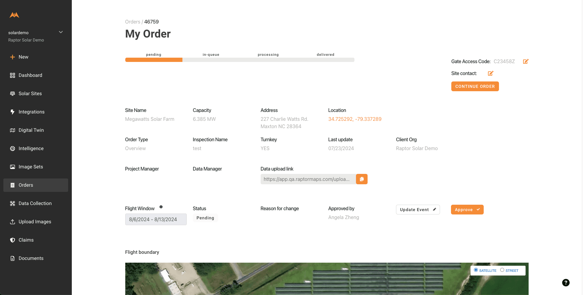
Selecting an order from the orders list brings you to an Order Details Page
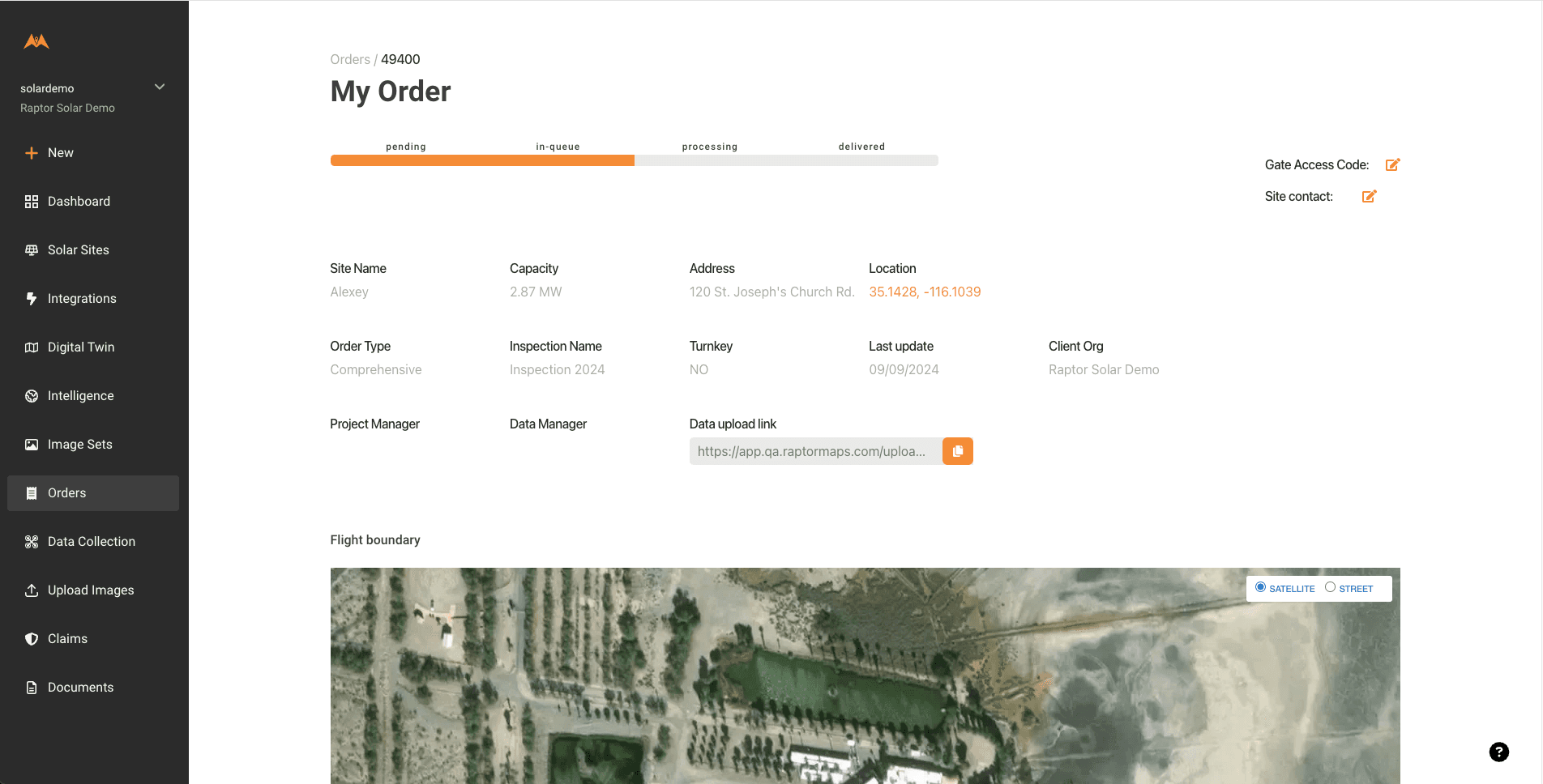
This page features order status and details, including the data upload link for self-collected imagery
Orders can be searched by site name or Order ID
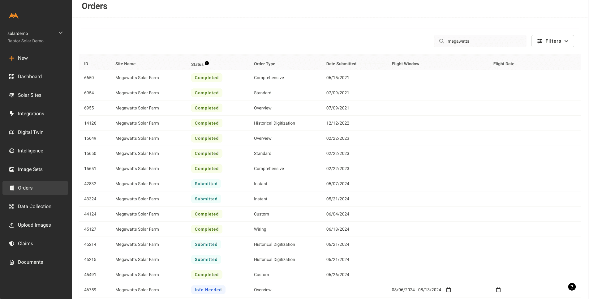
Use the search bar to see all orders for a site or to search by Order ID
Orders can be filtered by several categories, including Order Status. Order lists can also be sorted by column.
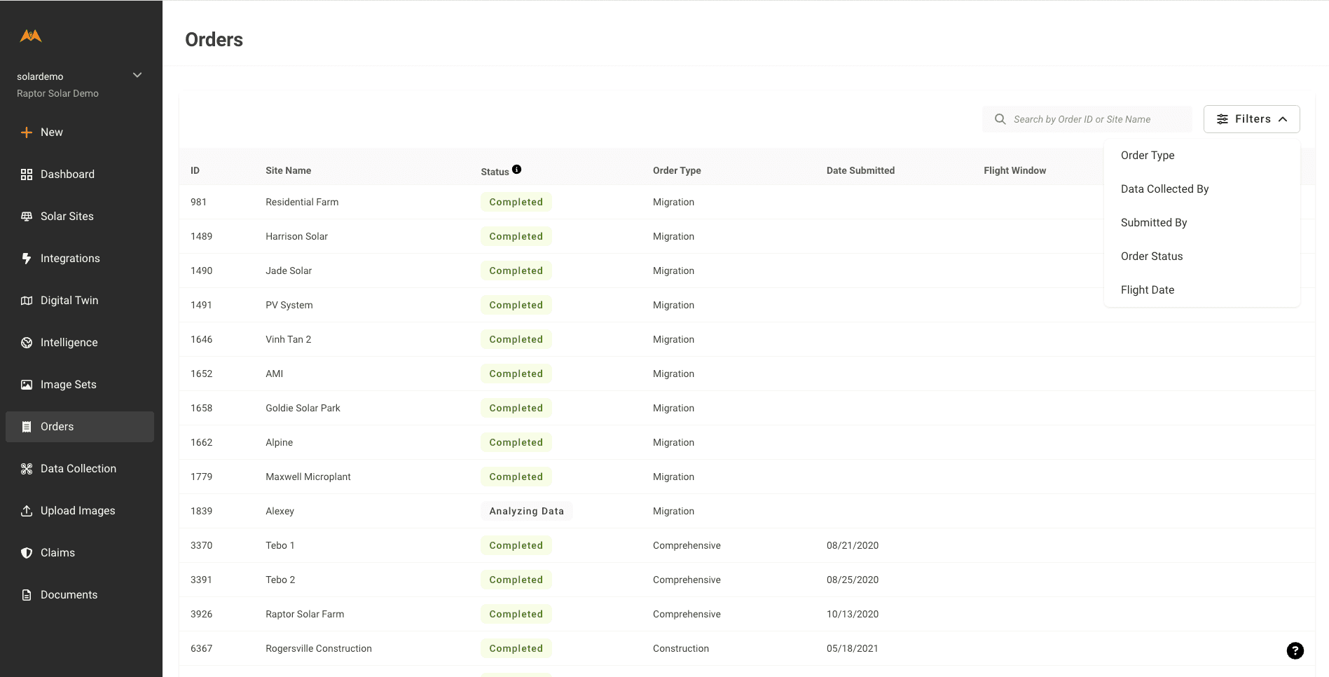
Filtering by Order Status can quickly show which orders require submission to move forward
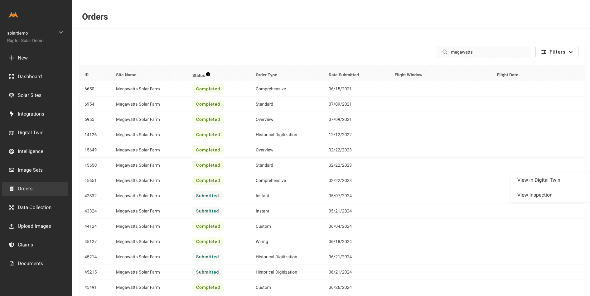
For Completed orders, users can navigate directly to a deliverable from the Orders page. Use the three dots when hovering over an order to navigate to the Digital Twin or an Inspection report.
Questions about order status or order type? Click here to learn more.
Submitting Site Digitization Orders
Digitization of each of your solar assets is a key step in utilizing the features found within Raptor Solar. This step occurs only once, but the deliverable, known as the Digital Twin is where data layers of your solar asset can be accessed.
Site Digitization orders are required to be submitted in the following circumstances:
-
A net-new solar site in your Raptor Maps account will be scanned for serial numbers without an aerial flyover
-
A net-new solar site in your Raptor Maps account will be scanned for serial numbers before an aerial flyover is performed
Raptor Maps encourages users to submit a site digitization order so they can begin using the Digital Twin as soon as possible. For example: site technicians may use the mobile app to perform site walks and log equipment notes to the Digital Twin.
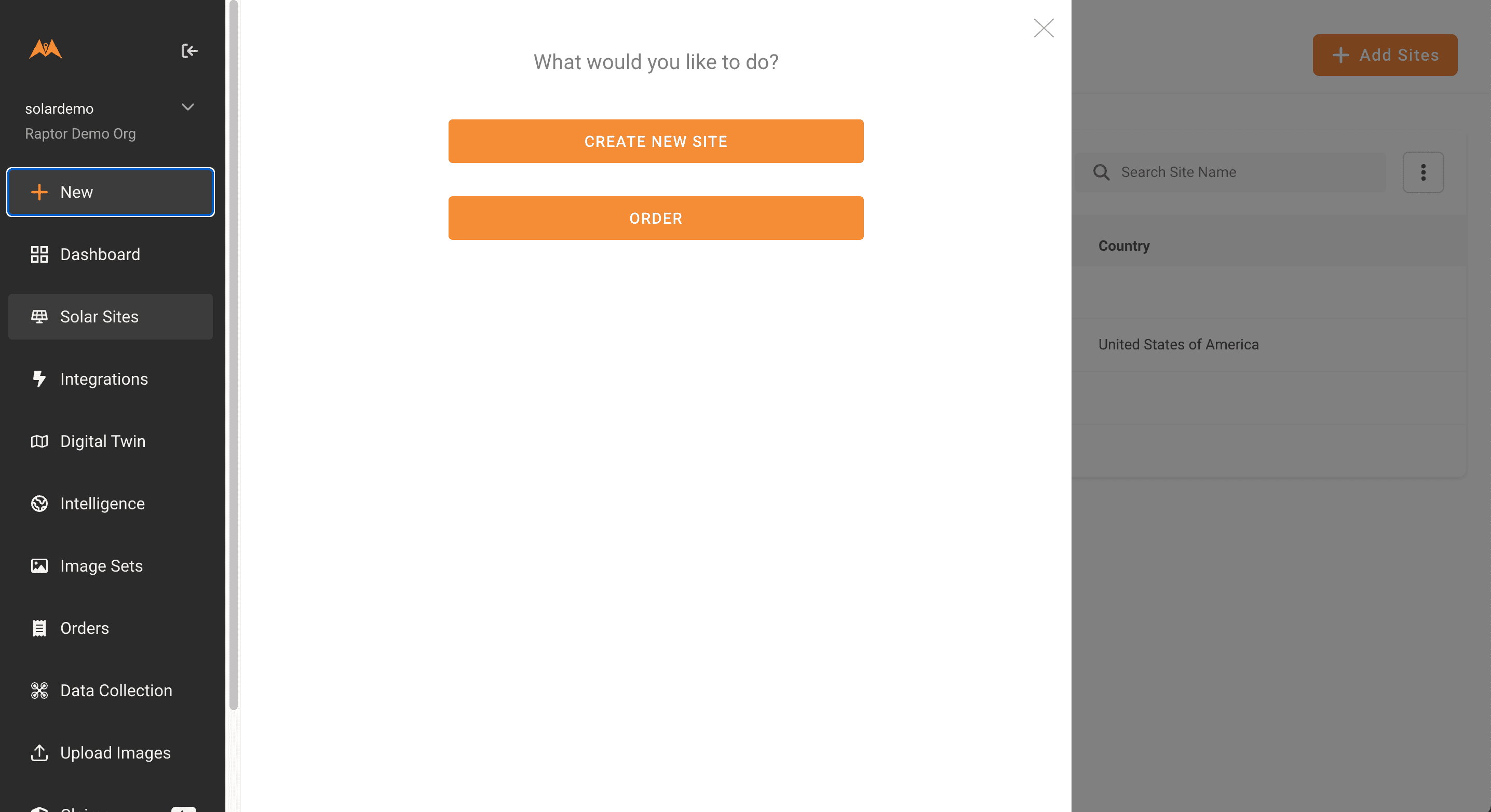
Select the “+New” button in the left control pane, then select "Order".
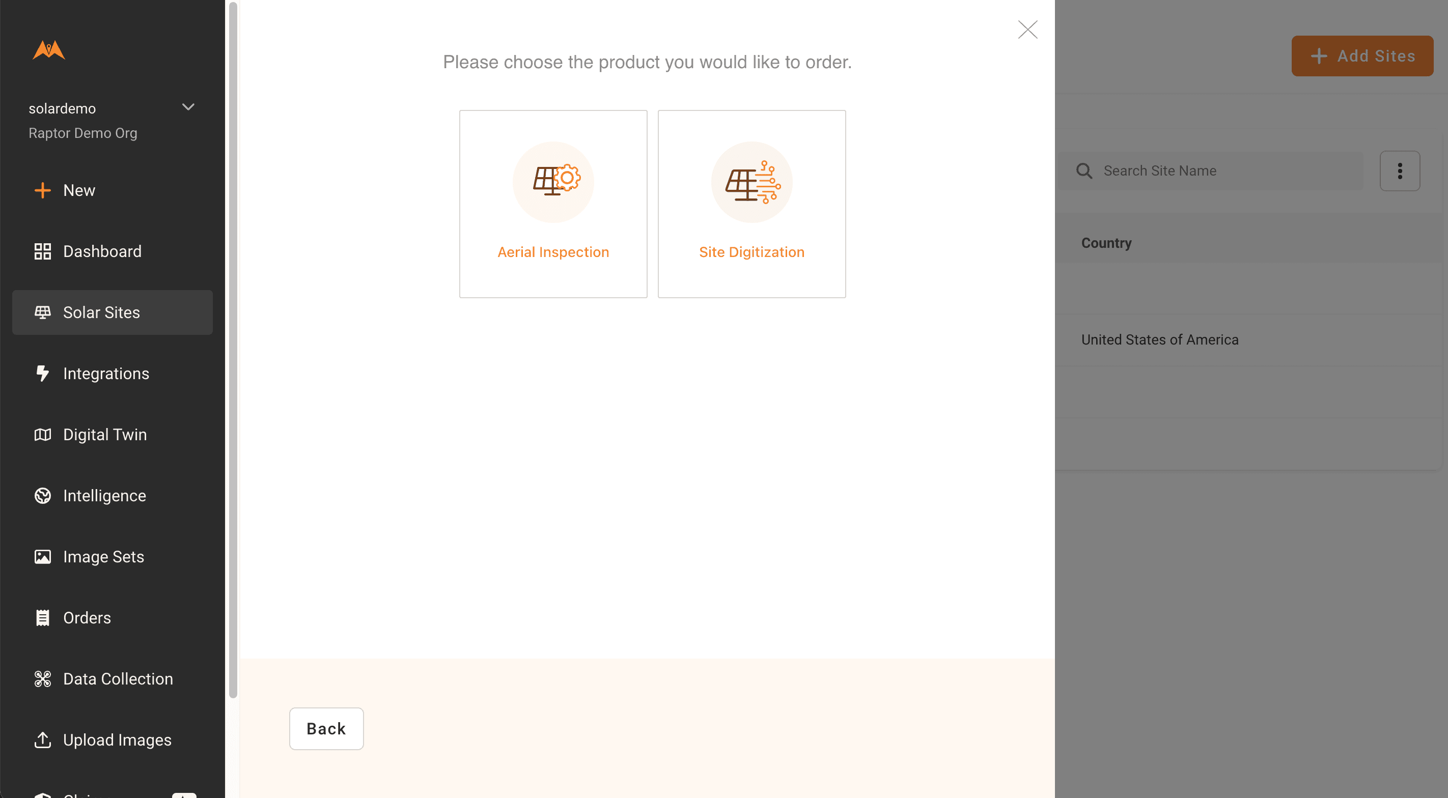
Select "Site Digitization".
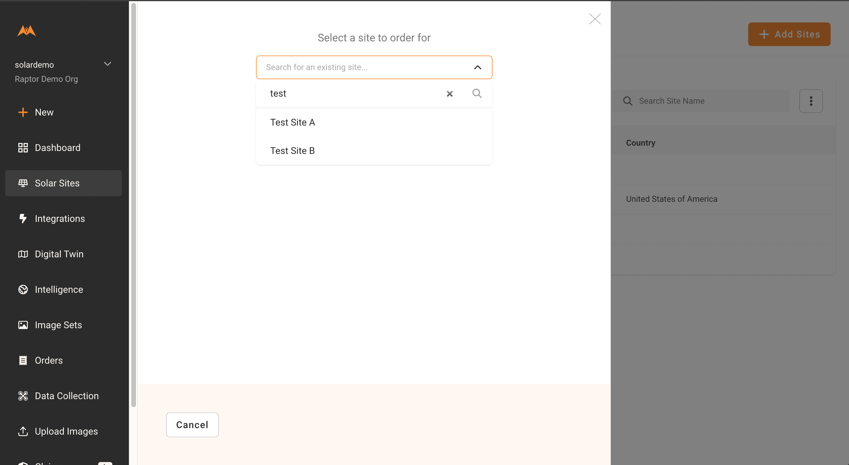
You will be prompted to select a site from your sites list. If you have not yet created your site, please see the How to Create a Site video, part of the Getting Started series of walkthroughs.
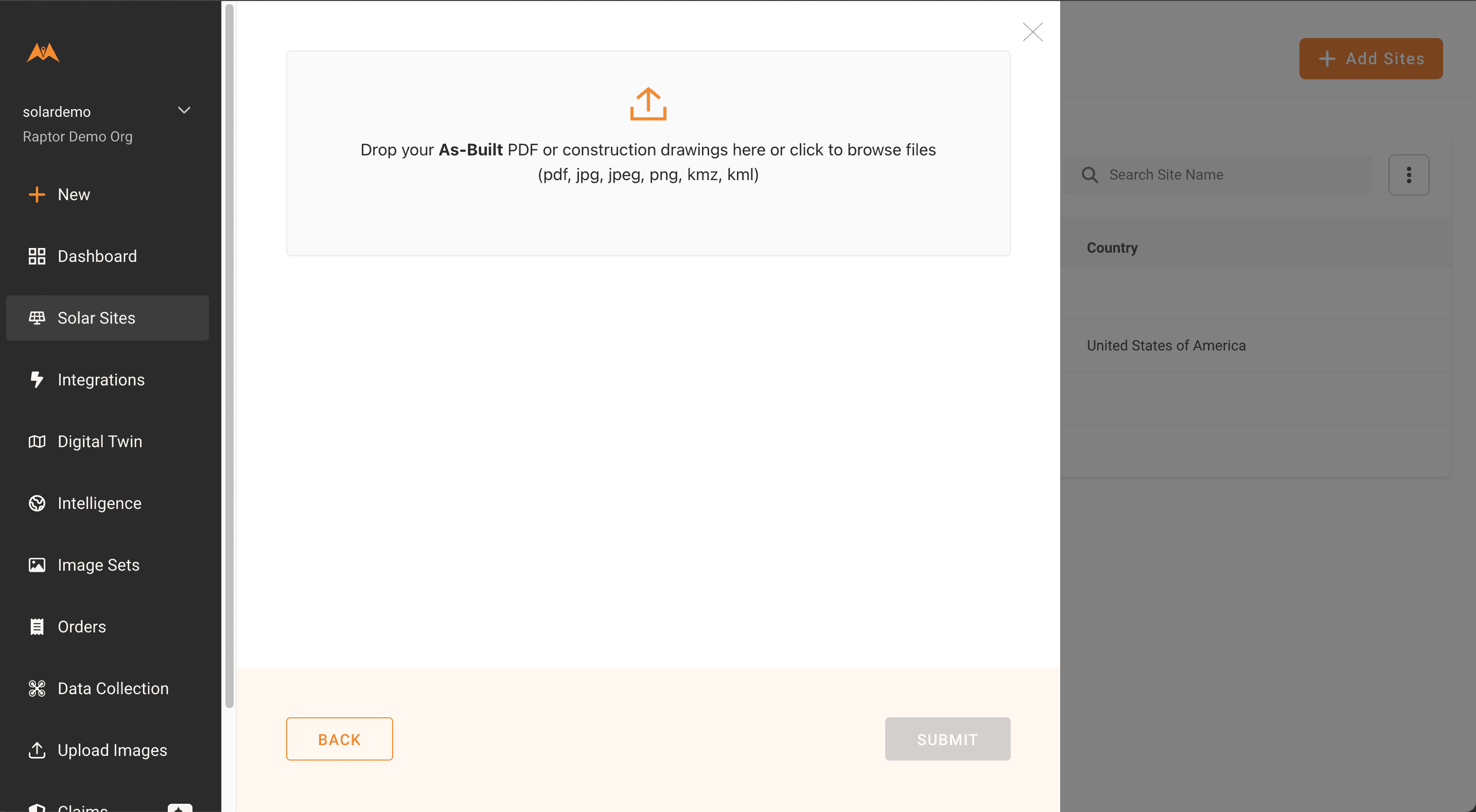
Once the site is selected, upload your as-built, ensuring a site wiring layout is included in the document. If available, please also submit a KML with tracker locations. See here for more details on as-built requirements.
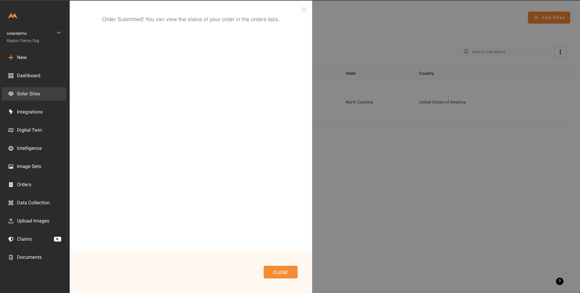
Select "Submit". You should receive a confirmation message and email. You can view the status of the order on your Orders page.
Submitting Aerial Orders
Orders with Raptor Maps contracted data collection (“turnkey” orders)
If you're self-collecting data, see Orders with self-collected data (“non-turnkey” orders) below
Turnkey orders will be onboarded by Raptor Maps and visible in the Orders page list view.
Navigate to the Orders page and filter by “Info Needed” status. This will display pending orders that require submission.
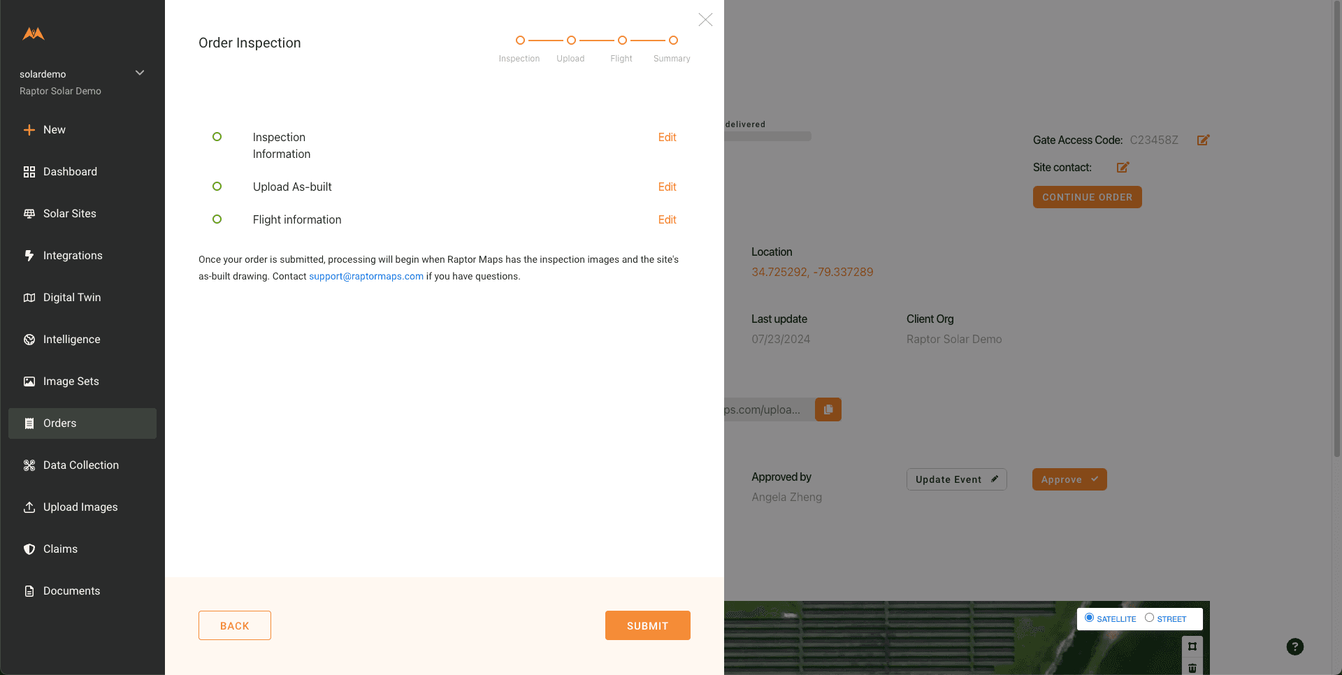
Select the order you wish to submit, then select the Continue Order button
Follow the order modal instructions where inspection and site details can be filled out and confirmed.
If you don't see the correct site contact listed, follow the link below the contact field: "Don't see your inspection contact? Add a new one here."
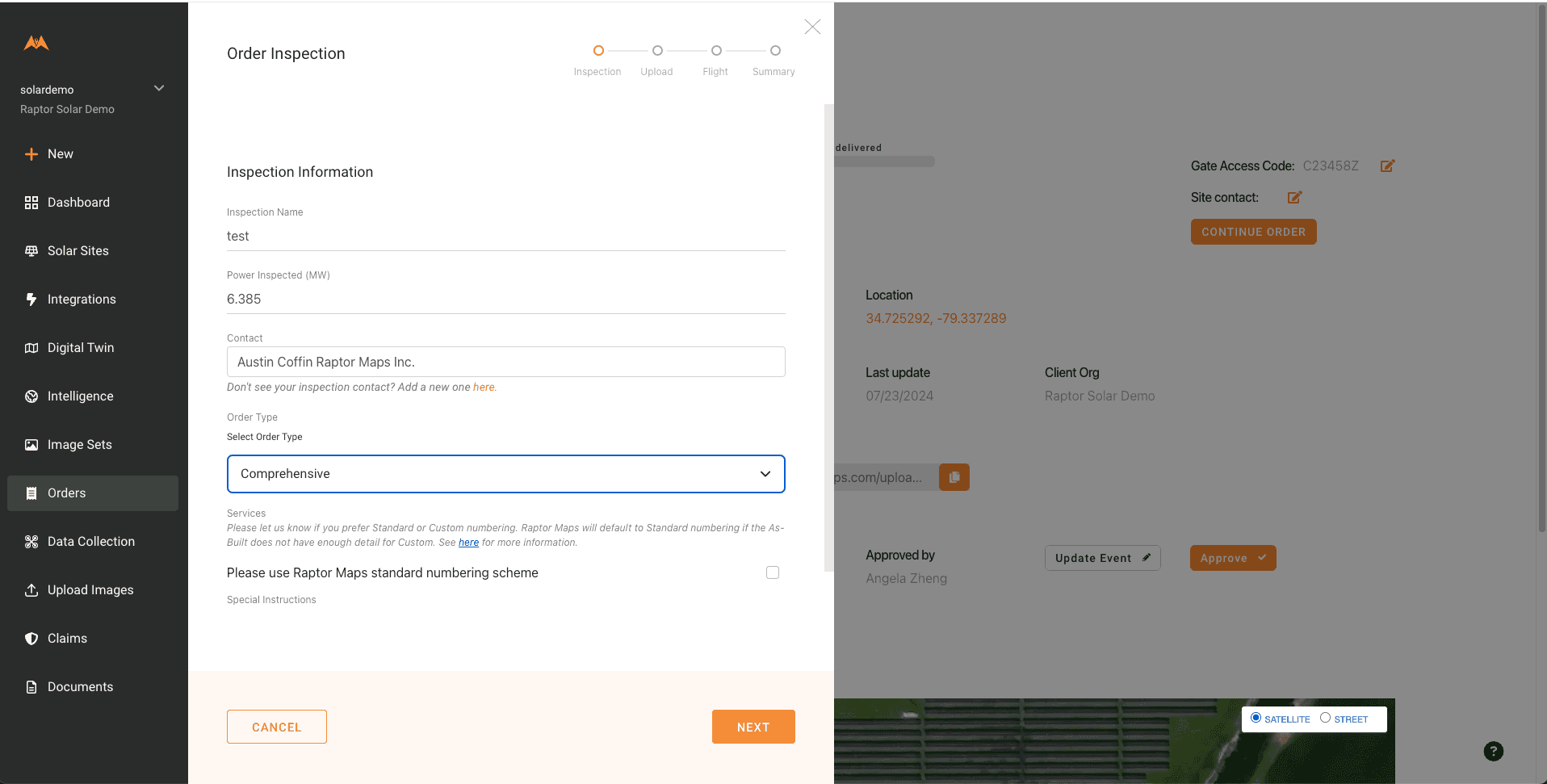
Select Next when details are complete

Upload an as-built with a site layout diagram that includes wiring details. If you do not have any site files to provide or if you are submitting a repeat inspection, click the checkbox below the as-built upload field. Please see here for as-built guidelines.
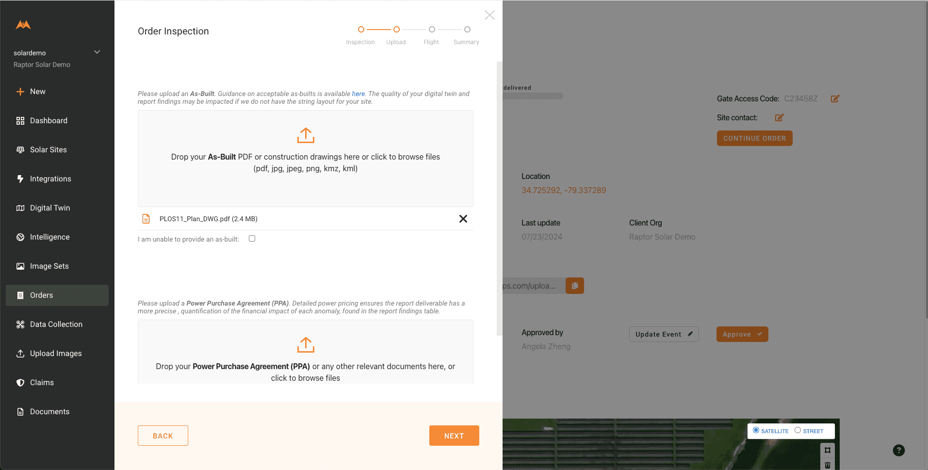
If you have previously provided layout documentation for a site, you do not need to re-upload it
On the next page, fill out the data capture availability window.
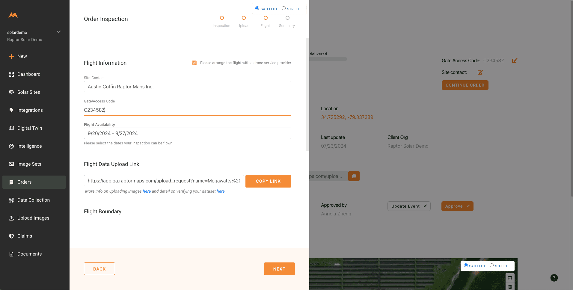
Flight availability lets the flight coordination team know when to schedule a pilot.
The last page summarizes the order info. Click ‘Submit’ to complete the order submission. Users who submit an order will receive a confirmation email.
Orders with self-collected data (“non-turnkey” orders)
All non-turnkey orders must be created and submitted manually by a user in the customer’s organization.
Non-turnkey orders also require users to upload all imagery to a submitted order before it will move to processing.
Once an order has been created and submitted, it can be accessed via the Orders page.
In the event of questions or data issues for a non-turnkey order, a member of the Raptor Maps team will reach out for clarification on next steps.
Order Status
Please see the table below for definitions of Order Statuses
Order Status |
Definition |
|
Info Needed |
This Order requires you to provide additional information before the Raptor Maps team can proceed. Orders requiring submission will be in this status. |
|
Submitted |
An order has been submitted to Raptor Maps and is being reviewed. |
|
Digitizing Site |
The Raptor Maps team is creating a digital twin for your site. |
|
Flight Date Needed |
The Raptor Maps team needs a confirmed Flight Date within the approved Flight Window before this Order can proceed to data collection. |
|
Awaiting Your Data |
Raptor Maps is waiting for completion of a non-turnkey flight and for the data to be uploaded via the Data Upload link. |
|
Awaiting Raptor Maps Flight |
A flight date has be scheduled but the site has not been flown yet. |
|
Data Uploading |
The data has been captured and is being uploaded to the Raptor Solar system for review. |
|
Checking Data |
Raptor Maps is reviewing the uploaded data to ensure the imagery meets our quality standards. |
|
Data Quality Issue |
An issue has been identified by the Raptor Maps team and the site will need to be reflown. Examples of issues include:
Please see our data requirements for more information. |
|
Analyzing Data |
The data has been successfully uploaded, checks completed and Raptor Maps is analyzing the data for anomalies. |
|
Completed |
The data has been fully analyzed and your inspection has been delivered. |