Note: Users will need the "Create New Solar Reports" and "Upload Files" permissions enabled to submit orders with site documentation. Org Admins can manage permissions following these instructions.
Collect this information if you are requesting the first inspection of a new site:
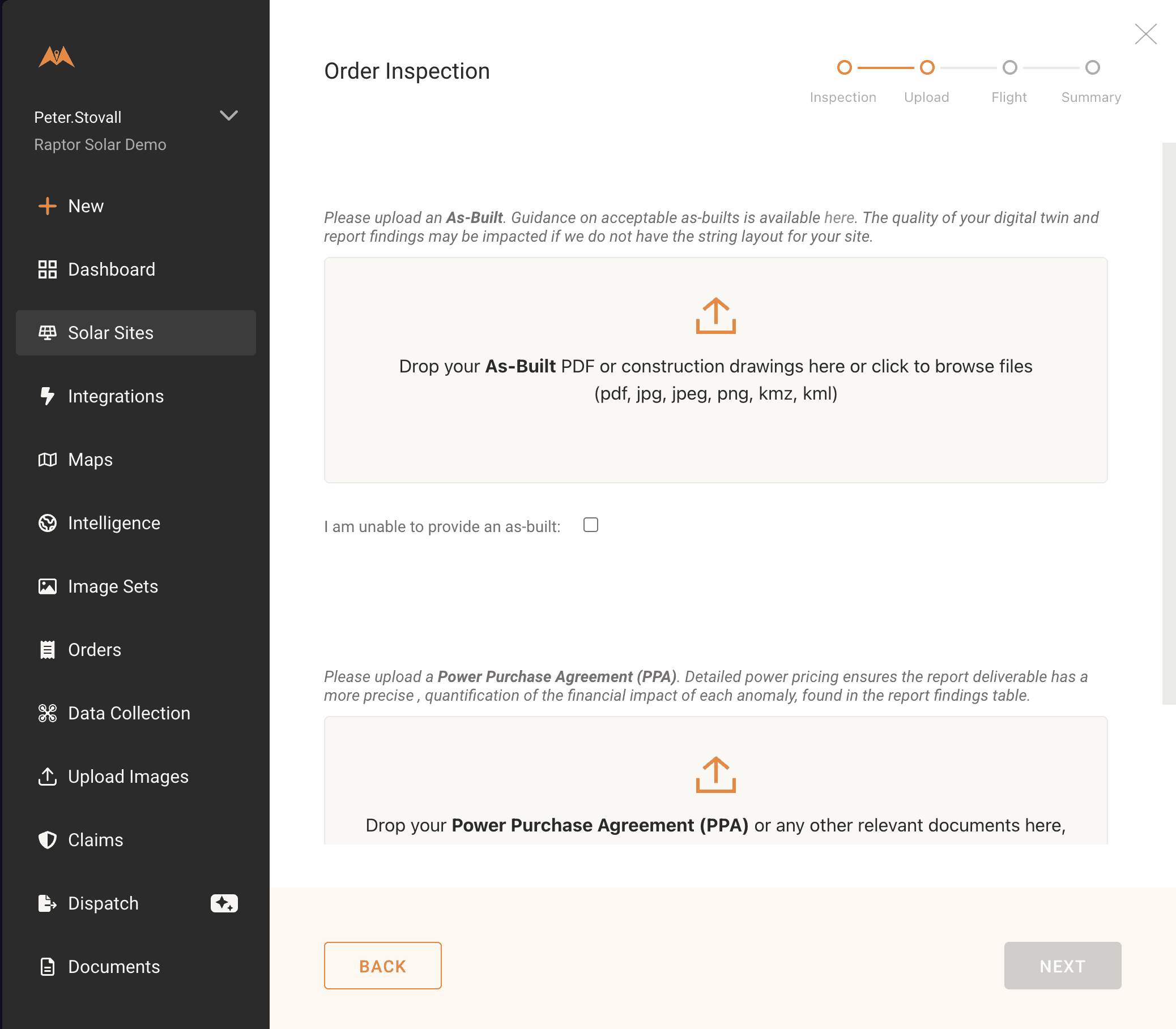
- As-built: full site pdf as-built. Please see here for details.
- Site address: site address as it will appear on the report
- Latitude/longitude: coordinates of the site location to at least 5 decimal places
- Commissioning date: date the site was commissioned
- Solar modules: solar module or modules in use at the site
- Tracking / mounting technology: tracker or mount technology in use at the site
- Module layout: number of modules per string
- Inverters: inverter type in use at the site
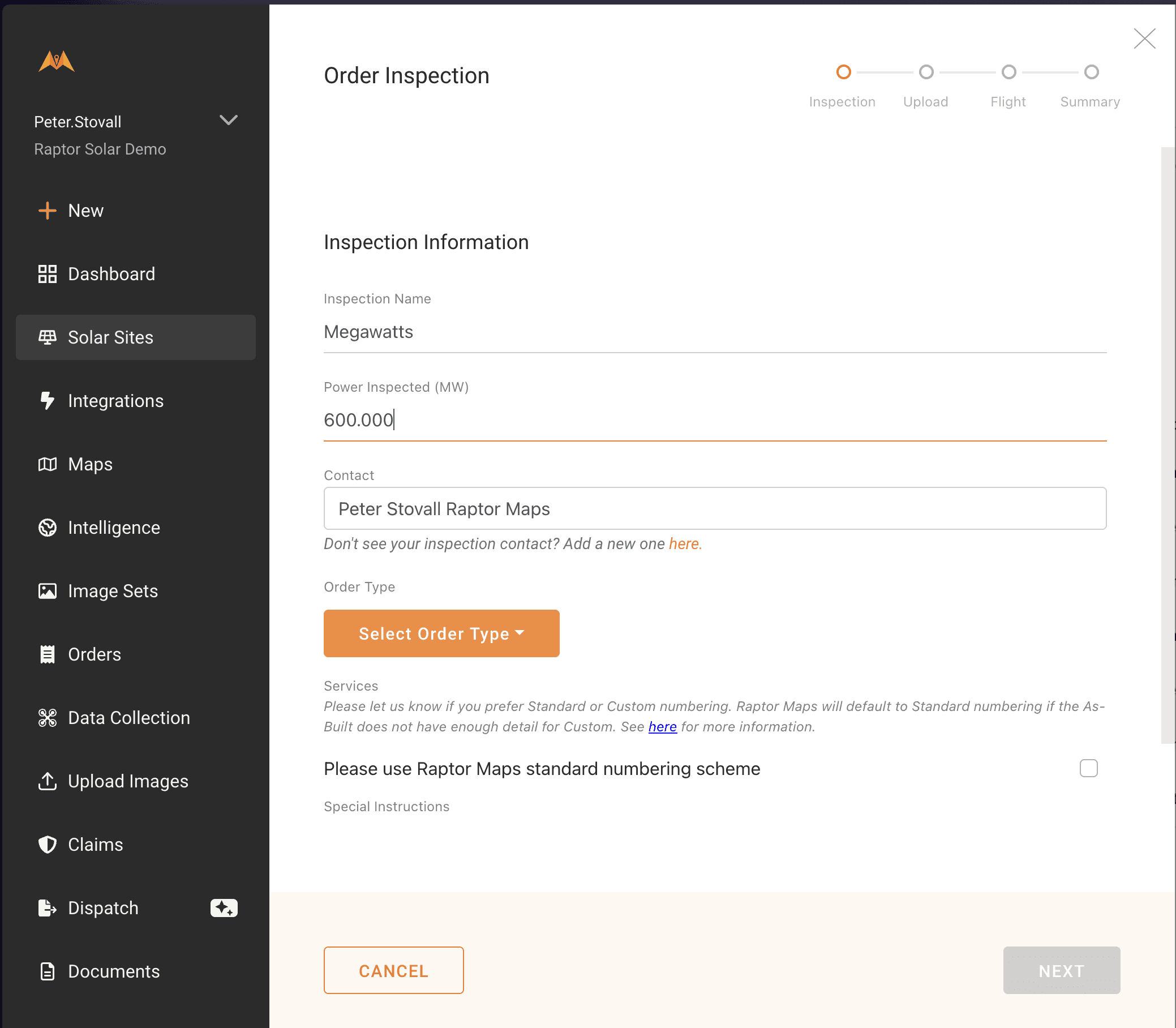
Inspection information: Provide the specifics for a new inspection.
- Name: means of identifying this inspection; for example "Raptor Spring 2025"
- Power Inspected: MW of power being inspected to the nearest known decimal place. If only a portion of a site is being inspected, specify the size of that portion
- Contact: Contact for the inspection. This is the name that appears on the report.
- Order Type: Raptor Maps category of inspection (e.g. "Comprehensive")
Flight information: Provide this only if your organization is collecting data for the inspection.
- UAS Model: Model of the drone, e.g "DJI M3T"
- Imaging System: Camera used to capture images, e.g. "Zenmuse XT2"
Ordering a New Inspection
This step only needs to be completed if there is not already an existing order for the site being inspected. To confirm if an order already exists, please see Viewing & Submitting Pending Orders.
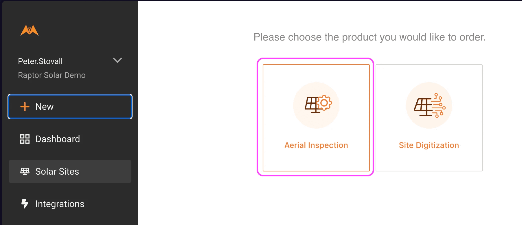
To provide the information necessary for a new inspection, select on “New” in the left side menu, then click on "Aerial Inspection".
Find the site and click on Next to continue to the Request Inspection page.
Provide the report details required for a new inspection. There are two types of new inspections:
- The first inspection of a new site (inputting site details will be required)
- A new inspection for an existing site (site details will be bypassed)
Next, upload the as-built for the site - we need an as-built and a complete set of images to begin processing your report. Note: for a repeat inspection of a site, you will not need to upload the as-built again as part of the order-submission process.
For more information on providing a good as-built, refer to Providing Information to Digitize Your Site.
After uploading the as-built, click on Save and Continue to specify the drone and imaging system used for the inspection. Only fill out this section if your organization is collecting the aerial data.
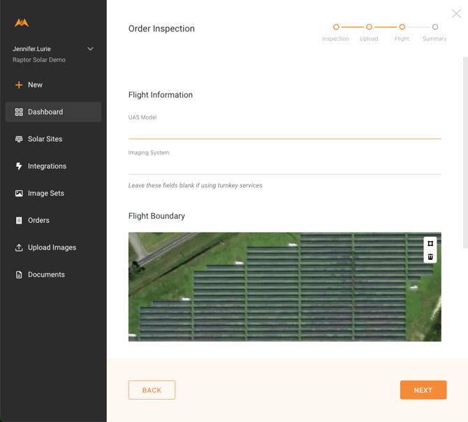
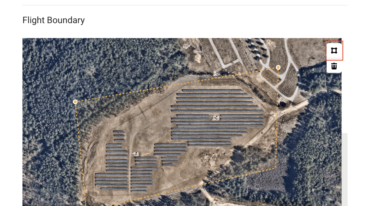
Recommended for sites that are adjacent/co-located with other solar installations: Use the polygon button (highlighted in red) to draw flight boundaries for data validation. After drawing flight boundaries, press ENTER key to confirm and save.
Select on Save and Review to continue to the Summary page, where you can submit your order:
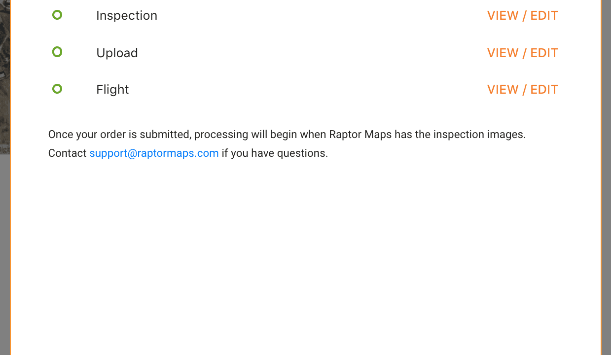
You’ll receive a confirmation email once you’ve submitted your order.
Submitting the order with the as-built is the first step in generating your report. Raptor Maps will begin processing the order once the inspection data has been uploaded.